Events
While Paul and Mary Ann were out on an evening walk in central Utah, where much of the earth’s geologic past is laid bare, Mary Ann saw something she’d never seen before. There, on the canyon floor, she found a single three-toed footprint cast in stone, followed by another and another.
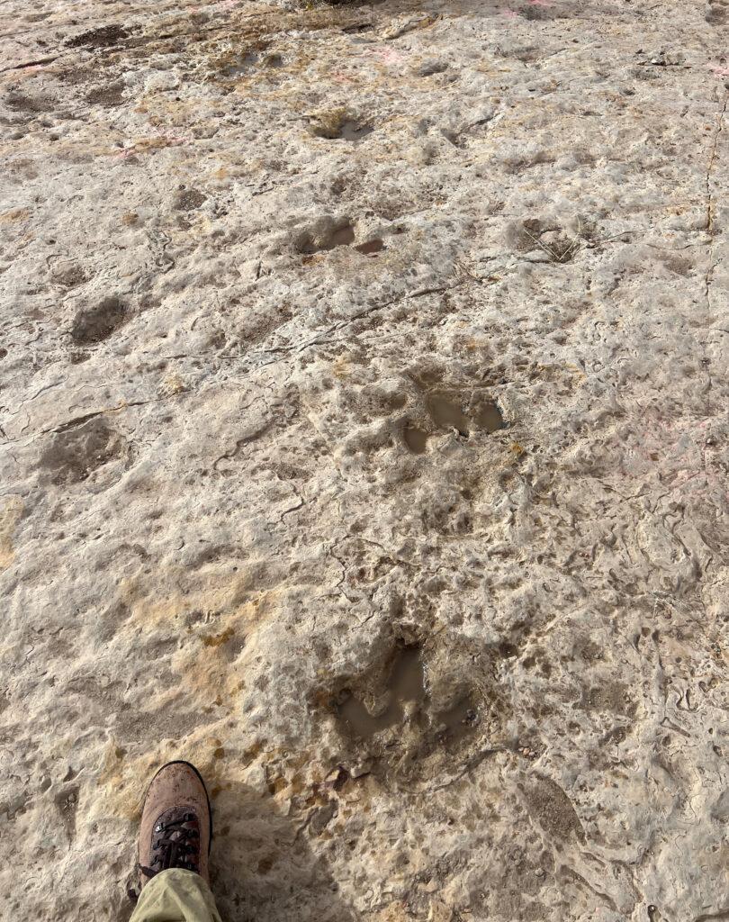
Before they knew it, there were more tracks than they could count. And more than just one set of footprints, there were many. Like a prehistoric game trail, the tracks stretched across the canyon floor, back and forth between two long-obscured locations. A river delta? A shoreline? No one could say for sure.
As a retired geologist, Paul could say that no one had documented these tracks before. While dinosaur tracks had occasionally been found in the area, trackways are uncommon, and as far as he knew, that one hadn’t been studied.
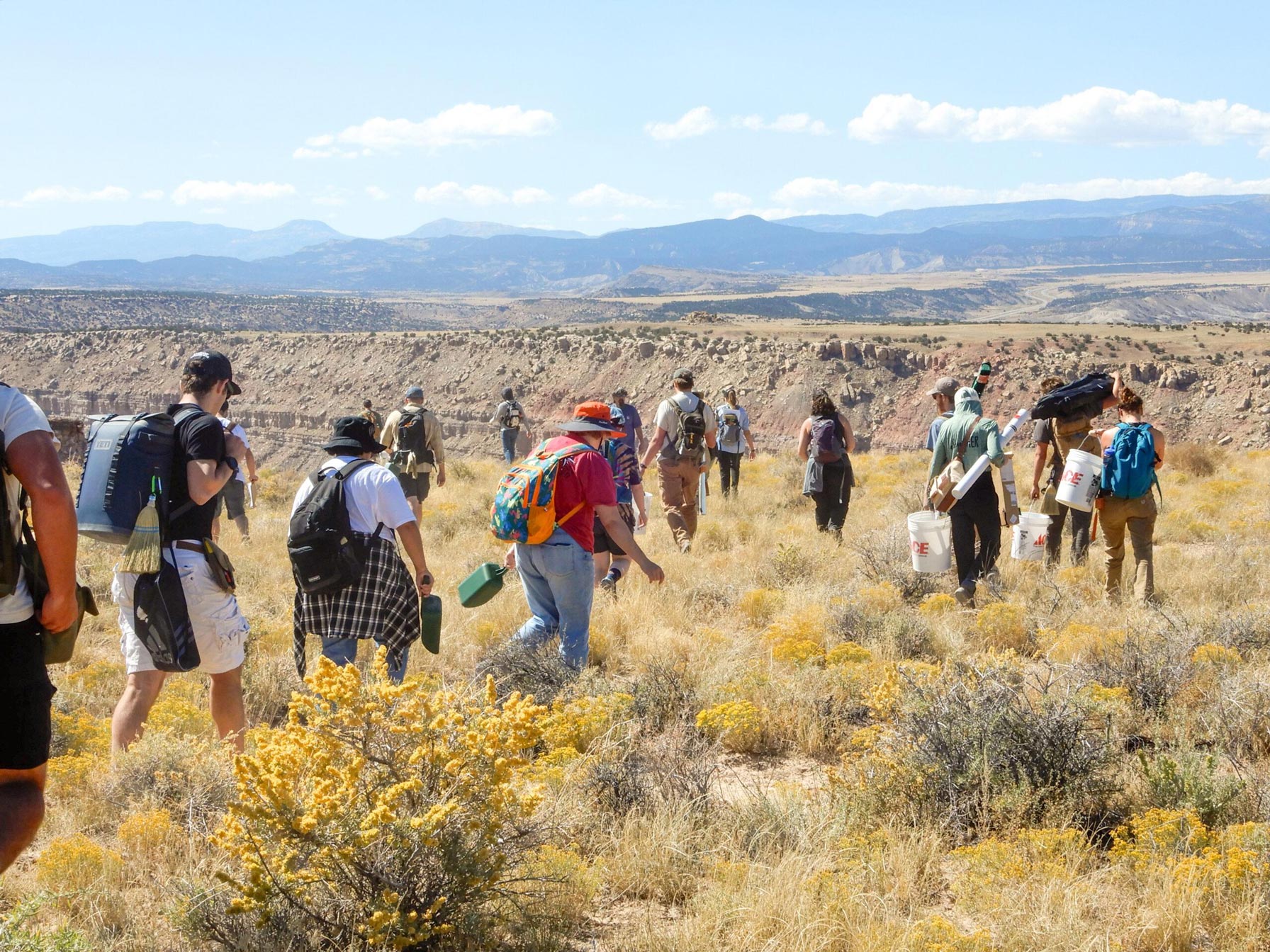
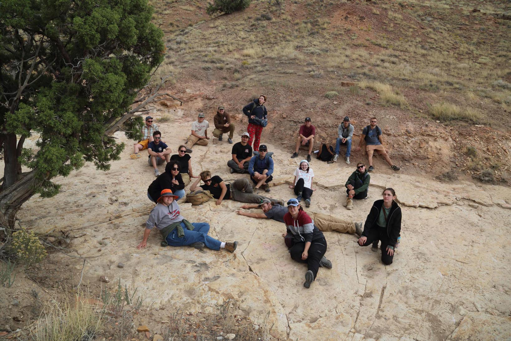
After making the discovery, Paul notified the state paleontologist and sent a photo of the tracks to Dr. Ryan King, a geology lecturer at Western Colorado University who holds Bureau of Land Management permits to conduct paleontological studies in Utah. King is always looking for opportunities to take his students into the field. So, in September, he and 20 students piled into vans and made for the Beehive State for a weekend of field research.
“I’m happy anytime I can get students out of the classroom and into the field,” Dr. King said.
After getting more detailed permission and setting up camp at a nearby state park, the students spread out to assess the site. The trackway is long and narrow, measuring 13 meters wide and more than 38 meters long, and contains at least 104 distinct tracks. The ancient path the dinosaurs took was broken and offset, like a clean fracture midway through a bone.
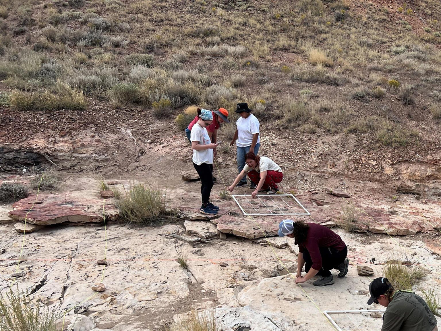
The 90-million-year-old tracks themselves were dirty, or in some cases completely covered, and would need to be cleaned in order to make a full analysis. Students busied themselves staking out heavy string to make a grid of 1-meter squares, each divided into 20-centimeter quadrants. Then they made a plan, divvied up the tracks in the grid, and went to work measuring and illustrating each track.
“Seeing these tracks for the first time was very exciting, but the real magic happened after we began to sweep the dirt off of the track site,” fourth-year geology student Abigail Krueger said. “Each individual track became so much more pronounced, and we began to make connections between the tracks that were going in the same direction.”
From the Classroom to the Canyon
It wasn’t the first time the class had analyzed a fossil. Before leaving Western for Utah, King and his students looked at replica tracks and discussed what they were looking for and why. They also talked about what constitutes a good question in the context of scientific inquiry and studied research papers that described the process for measuring a fossilized footprint and practiced taking the measurements. “A lot of the tracks look like the exact same thing unless you take quantitative measures and try to differentiate them,” Dr. King said. “The devil’s in the details.”
In the field, they were able to identify the dinosaurs as mostly ornithopods, tell approximately how tall they were, how fast they were moving, and whether they changed speed. Over two days in the field, they studied and measured every track they could find, traced its outline on a map of the canyon floor, and made hypotheses about the animals’ movements.
“We needed to keep our notes very organized and take pictures so we could understand our findings when we were back on campus,” Krueger said. After returning to Gunnison, from their observations, students organized and presented their findings related to specific research questions and made a case for their conclusions in a paper.
The research may lead to opportunities for students to present their findings at the Geological Society of America’s regional conference in May. “Hopefully, it engages them enough to invest more time outside of class searching for answers to some of these questions or potentially to test their conclusions amongst their scientific peers at a conference or in a journal article,” Dr. King said.
After spending years scouring the exposed geology of central and southwestern Utah and western Colorado for signs of the prehistoric past, Dr. King has cataloged many other track sites for potential research, where students could be the first to investigate and document dinosaur tracks.
“I feel very lucky to have had the opportunity to do research on a trackway that has not been studied yet,” Krueger said. “This gives me confidence in my abilities to conduct accurate research and complete a large project like this without having someone tell us what to do at each step of the way.”
This project was executed under Bureau of Land Management Paleontological Resource Permit UT24-011 to M.R. King. Permits are required for any interaction with protected resources (e.g. vertebrate fossils) on public lands. Thank you to Dr. Emily Lessner and the Price District BLM office for their assistance.
Interested in applying?
Contact the Department for more info.
Author Credit: Seth Mensing
Photo Credit: Courtesy
Related Stories